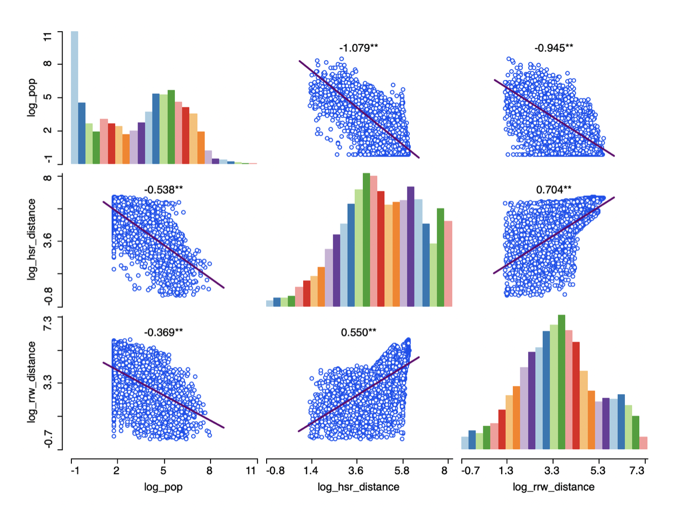
China high-speed rail regression model
Using a Spatial Error model to predict distance to nearest high-speed rail line using regular railway infrastructure and population density
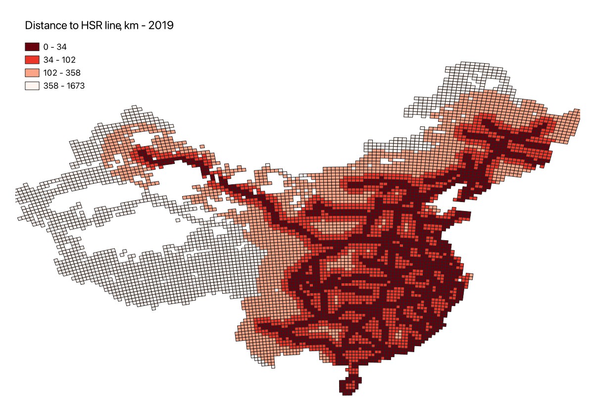
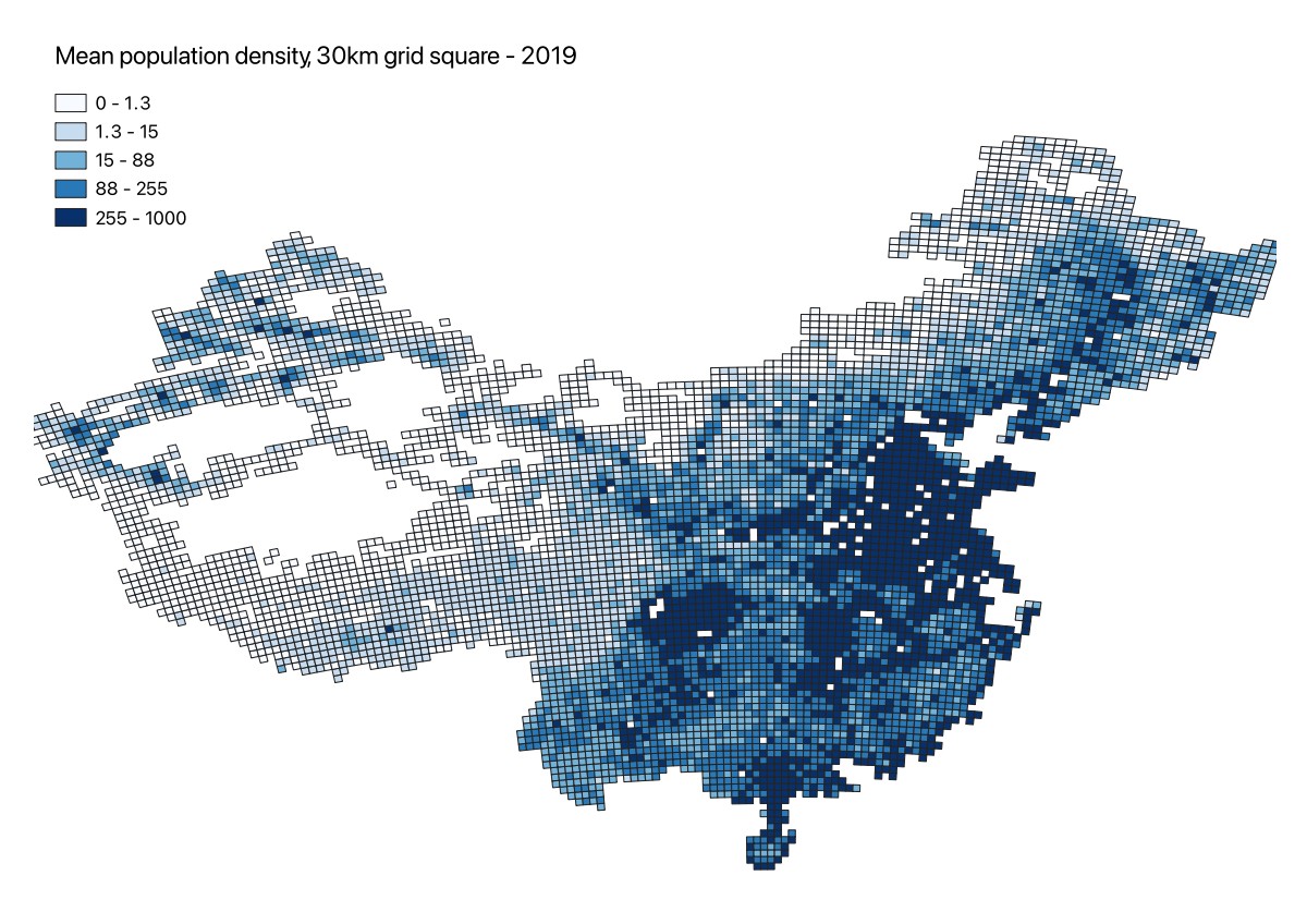
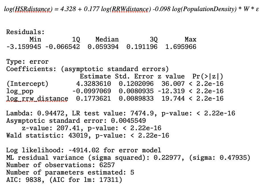
As part of my studies in geographic data science I chose to investigate whether population density and proximity to existing regular railway lines could predict how close a location in China is to a high speed rail line. Using a 30km grid square dataset covering mainland China in 2019 (this was the most recent year where I could get a complete railway infrastructure dataset), I developed a regression model that was respecified from OLS to a spatial error model to account for the inherently spatial nature of transport infrastructure.
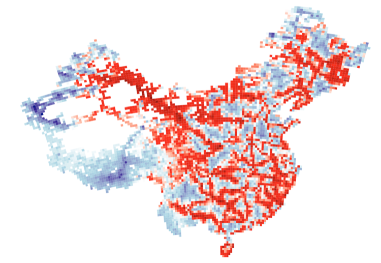
The top image is an extract showing the spatial autocorrelation of the residuals from the OLS model, which was fixed by changing to a Spatial error model.
Sources: https://www.hoover.org/sites/default/files/research/docs/25104-Davis-Qian-Zeng-2.pdf https://hub.worldpop.org/geodata/summary?id=44833