Joseph C
Home
Info
Writing
Tags
Tools
Aug 29, 2025
Semblance Geospatial
Jul 04, 2025
US immigration detention footprints
Jan 01, 2024
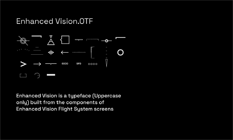
Enhanced Vision.OTF
Feb 20, 2023
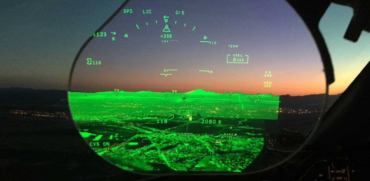
Enhanced Vision Systems
Jan 01, 2023
Black Hole